Polar Podcasts
Polar Podcasts
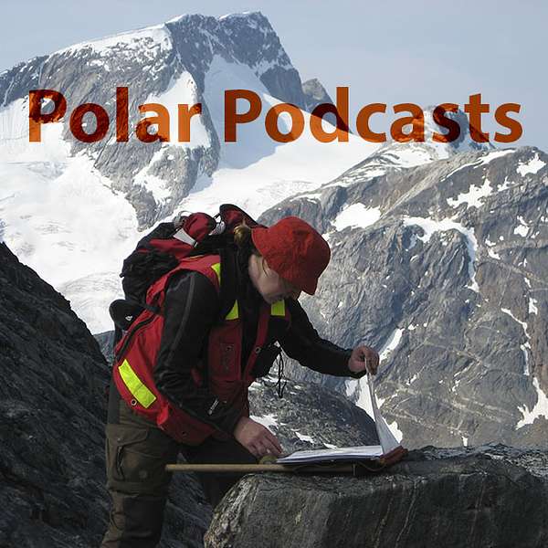
11: Bjørn Thomassen and Kent Brooks: The discovery of the Flammefjeld porphyry molybdenum deposit
In this episode, we hear from Kent Brooks, emeritus Professor at the Geological Museum in Copenhagen, and Bjørn Thomassen, emeritus senior scientist at the Geological Survey of Denmark and Greenland, about the summers of 1970 and 71 working for the Nordic Mining Company in East Greenland, when they discovered Flammefjeld, a spectacular red and yellow mountain that hides a buried mineral deposit, still undrilled fifty years later.
Transcript
Bjørn Thomassen and Kent Brooks: The discovery of the Flammefjeld porphyry molybdenum deposit
Based on interviews held on September 30–October 2, 2019 in Copenhagen, Denmark and on interviews held on January 9–10, 2020 in Kendal, England
Note: Polar Podcasts are designed to be heard. If you are able, please listen to the audio, which includes emotion and emphasis that is not evident in the transcript.
________________________
Bjørn 0:00
I mean fieldwork it’s, it’s like a marriage without sex, so to speak because you’re together all, all, all the time.
Julie 0:08
Welcome to Polar Podcasts, where you’ll hear stories from geologists who’ve spent their careers, their lives, exploring and studying the remarkable and remote geology of Greenland. Why did they become fascinated with Greenland? What were the problems and the discoveries that drove them? And what was it like working in these remote places, where few people venture, even now? I’m Julie Hollis.
In this episode, we hear from Kent Brooks, emeritus Professor at the Geological Museum in Copenhagen, and Bjørn Thomassen, emeritus senior scientist at the Geological Survey of Denmark and Greenland, about the summers of 1970 and 71 working for the Nordic Mining Company in East Greenland, when they discovered Flammefjeld, a spectacular red and yellow mountain that hides a buried mineral deposit, still undrilled fifty years later.
Kent 1:04
Well the Northern Mining Company, although a Danish company, it er, it’s chief geologist was a chap called Erik Hintsteiner, who was an Austrian and he never had any, any real communication with, with Danes at all. All the prospectors they had came from Austria. And so essentially, I was the first, the first one, non- non-Austrian to take part in it. And er, I had Bjørn Thomassen was my assistant on that.
Bjørn 1:32
I was assistant for a British geologist called Kent Brooks. We had two er, splendid summers er, 1970 and 1971. And that was fun because you know, you’re two persons and you get quite close during the two months because you er, I mean field work it’s, it’s like a marriage without sex so to speak because you are together all, all, all the time.
Normally er, Nordisk Mineselskab operated in the area around Mestersvig – Scoresbysund to Clavering Ø – but our main assets, in that area, that was Malmbjerg, the huge porphyry moly deposit, molybdenum deposit. And that was, that is associated with er, Tertiary intrusive rocks.
Julie 2:19
The Tertiary – a term that is now subdivided into the Paleogene and Neogene – is a geological time period from 66 to about two and a half million years ago. Mainly the early part of this period – the Paleogene – saw huge volumes of basaltic lava erupted during rifting of East Greenland from Scandanavia and the opening of the Greenland Sea and producing the Skærgaard intrusion, and also the mineralized granites that Bjørn talks about.
Bjørn 2:45
It’s a small granite stock er, which hosts the molybdenum. So we knew that we had similar rocks five hundred kilometres further south at er, Kangerlussuaq. Er, many places in Greenland are called Kangerlussuaq, so we better call it the Skærgaard area because Skærgaard is – among geologists – a well known locality because there’s a gabbroic intrusion there, beautiful structures, layering and things like that. So it’s, it’s a textbook locality.
But there are Tertiary intrusions in the area. There’s a er, big syenitic intrusion, same, same rock family as Malmbjerg er, also granite nearby, same age. So the idea in 1970 was let’s take down there and take a look at those intrusions and see if we can find a Malmbjerg number two – a new Malmbjerg deposit.
So we flew down. That was a fantastic helicopter from Scoresbysund to Skærgaard er, along the Blosseville coast. A very scenic and in a way frightening because it consists of black basaltic rocks you know standing steep out of the water and glaciers in all the valleys.
Kent 3:57
In those days we had an Alouette helicopter and it’s range was, was rather limited. So it had to be used in the first few weeks laying out fuel depots. It was like making a trip to the moon. You, you laid out, laid out fuel depots along the way. And every fuel depot, the further away it got the more, the more expensive it was to put it out, and the smaller it became. Anyhow, the day came we, we er, flew to Scoresbysund and overnighted in Scoresbysund in, in the doctor’s house. And they had a, they had a, a polar bear cub there as a pet. And I have a charming picture of it that many people, many people have admired. I also have a picture of Hintsteiner sleeping on the sofa in the doctor’s room and the polar bear cub licking his face.
Anyhow we, we flew, flew south there and er, it was quite a, quite a risky business in those days. Not many people flew in helicopters in Greenland in those days for a start. And for the other way we, we weren’t, weren’t sure whether we had enough fuel laid out to make it, or to make it and the, the, the chopper to return again. So er, anyhow we, we flew, flew, flew down the Blosseville coast fairly uneventfully and landed, landed at Skaergaard. And er, there were er, four of us from the Northern Mining Company on this job. A chap called Vohryzka and his wife, who was also a geologist, and er, me and Bjørn Thomassen.
Bjørn 5:24
So we were dumped at a place later called er, Nordminebugt er, at the mouth of the, of this huge fjord. So we were told well you have provisions here for a month and the helicopters will come back in one month and, and shift you over to Skærgaard. So we had our tents there and our provisions and a small alu dinghy, two and half metre long with an outboard motor which er, was no success, no success because there was too much ice in the water. So we were actually restricted to that area, which is quite mountainous. The highest mountain of er, Greenland, Gunnbjørn Fjeld, is just fifty kilometres northeast of the locality. It’s high country.
But anyway, we did our best, covered that area and the thing you do when, when you’re bound when you have no helicopter, no support, you operate out of the base as long as you can reach in a day, which is normally five kilometres in that sort of terrane. If you want to go further you have to carry a lightweight camp out and operate from that, and we did that. And one camp we had, was in a fjord called Amdrup Fjord. And I remember we were working, Kent and I, along the coast of Amdrup Fjord, (a) beautiful place by the way. You can say Greenland is beautiful all over but some places are more beautiful than others. And this is a more beautiful place.
Kent 6:44
Well the first thing we found was er, what we called Yellow Mountain in those days. When we climbed up to the top of the ridge above our camp we saw this striking mountain across the fjord, which was all red and yellow. And it was really a spectacular looking thing.
Bjørn 7:01
Very impressive. And the stream was coming up from the small valley there and was absolutely yellow. The whole top of that mountain is covered in, in rust, which rust is a popular name of alteration of iron-bearing minerals. And we had no helicopter, so we couldn’t reach it.
Kent 7:19
It turned out, turned out subsequently that it’s a porphyry molybdenum deposit. But we didn’t find that out until er, later anyhow. And er, it was one the, one of the two, the two molybdenum deposits in East Greenland I, I dated using the rhenium-osmium method, which er, gave really accurate dates for, for er, for these things. I dated Flammefjeld in Kangerlussuaq, and Malmbjerg, up by Mestersvig – the other big molybdenum deposit. So we got really accurate dates on them.
Anyhow, that was essentially, that was the only, only promising mineral deposit we found the whole summer. We found it the day after we first arrived. And then we spent the rest of the summer just wandering around looking for more but didn’t find any.
But then the following year, the Northern Mining Company decided they were going to have a much more ambitious expedition there. So they um, took on I think four or five groups, five groups maybe it was. Bjørn Thomassen and I were one of them and er, then the, the others were Austrians. There was Kurt Vohryzka and his wife again and there, there were two other groups called the Hochalpine Gruppen. They were er, they were er, selected because they were good climbers.
Bjørn 8:43
But next year we came back with a helicopter and made a landing and had a look at the rocks. And they were porphyries, granitic porphyritic granitic rock.
Julie 8:53
A porphyry is a kind of igneous rock usually formed along the margins of continents that is prospective for certain types of mineralization including copper, gold, silver, molybdenum, and tin.
Bjørn 9:05
And that was what we were looking for. And we found some sulfides but the not the right, you know er, porphyry type of moly deposits. The, the molybdenum mineral, molybdenite sulfide sitting on cracks, on tiny cracks, but the whole rock is like it’s crushed up. So it’s, it’s three dimensional er, meshwork, we call this stockwork, over a very large size. We’re talking tonnages of a hundred million tonnes. I mean Malmbjerg, depending on, on the cut-off grade it’s either a hundred million tonnes er, or two hundred million tonnes, it’s dying out slowly in all directions. So that’s the high grade core where you always start the mining.
We didn’t find that sort of mineralization that summer. We found other general base metal and with high silver concentrations of gold and things like that. Also moly, but wrong structure, more massive molybdenum.
Kent 10:00
The main result of this particular expedition, as far as I was concerned, was that the er, we discovered two very important intrusions in Kangerlussuaq, which we knew nothing about before. One of them was the Gardiner Intrusion, which er, is a Paleogene intrusion again. And it’s er, extremely interesting because it’s er, it’s really a, a mineral treasure trove. There are lots of wonderful er, museum specimen, museum-quality minerals there including perovskites, magnetite er, eudialyte, apatite, bariolamprophylite. And it’s just a, it’s just a mineral treasure trove. And it’s er, ten or twenty kilometres beyond the head of Kangerlussuaq fjord on the west side.
And it turns out to be a hell hole because it verges onto the inland ice. And the, the wind, the wind blows at gale force most of the time. And the original, the original two, two people from Nordmine who discovered it, they er, quickly had their tent blown to pieces. And they had to send the helicopter to Aputiteq to get, get er, baulks of timber so they could, they shore up the tent with heavy timber to stop it being blown away. Well we’ve been back to Gardiner on several occasions and er, we, we’ve always had these winds. They come off the inland ice down there almost incessantly and makes life, life intolerable. I mean the wind is so strong you could, you have to lean into it or you’ll in fear pof being blown away a lot of the time. Anyhow, that’s the Gardiner Intrusion. On the other side of the fjord is the, the Batbjerg Intrusion, or the Batbjerg Complex. And that turned out to be a Caledonian Intrusion.
Julie 11:52
The Caledonian Orogeny, or continental collision, occurred about 420 million years ago and during this period many, what are called Caledonian magmatic intrusions were formed.
Kent 12:04
But it’s also alkaline rocks and it’s er, it’s incredibly interesting because it has these er, these leucite-bearing rocks in it. Leucite is a, a relatively er, rare mineral. It only occurs in certain, certain igneous rocks in a few parts of the world like Italy and the African rift valley. And er, anyhow these rocks contain leucite and er, related minerals. And so it’s pretty unusual. And it remains to this day quite a mystery what it’s doing there. But one of the theories is that the er, the Batbjerg Intrusion is related to the, the Assynt Province in northwest Scotland, which has been detached from it by continental, continental drift.
Anyhow, we er, discovered, discovered those two things that year. That was 1971. 1972, I decided that er Nordmine, Nordmine wasn’t going back again, I decided if I wanted to go back I’d have to, have to do it myself.
Bjørn 13:02
Later Kent, he did a visit to that mountain with more time and he found er, blocks with that stockwork type of mineralization. That was 1981. And he told me and we decided, that was a decision made in part in, in Nordmine at that time. So we decided to take a licence over the mountain, red mountain, and so we had a field season in 1982 for us two geologists, two assistants, and we were put in with a helicopter from Ammassilik and er, taken out a month later. So we were put in the same way with provisions and everything. So we spent that month mapping out and sampling in detail the red mountain.
First, we were sitting there, and said, ‘red mountain’, it won’t do because there are so many red mountains in the world, also in the world of economic geology. So we would dream up a better, better name and we invented er, Flammefjeld – or Flame mountain – for several reasons. First, there’s fantastic colour when you look at and the sun is shining, it’s, it’s red and yellow all over because of the hydrothermal alteration products. And secondly, it’s nearly the same word in Danish and English because when you publish, it’s a world where everybody writes and speaks English. Because our market that’s the international er, community and we try to attract capital. Even as a small Danish company, if we were to go into mining we have to have expertise and er, capital from abroad. So everything goes in English. So we think Flammefjeld is a Danish word, but it’s I think Englishmen will understand it, it’s nearly the same. So we were proud of that name. So now it’s called Flammefjeld.
And then we did a detail, and my friend Asger Geyti, he’d been working with porphyries of, together with Amax, who had a licence in er, central east Greenland. And they had checked up on all the Tertiary intrusions. They’d checked them for porphyry copper, er moly. And the ore forming models for this type of mineralization came out very early, I think in the 50s, where the Americans er, put out this ‘Climax model’, which er, describes small granite stock, with several porphyritic phases, that means multiple intrusive phases. And so at the top of this er, small stock, we had a saucer-shaped, inverted saucer-shaped orebody, a hundred, two hundred million tonnes. The grade is not high. It’s about er, quarter of a percent er, molybdenum sulfides.
So that was our target and we used the methods we had learned up in central East Greenland. And that means we took detailed chip samples and analysed them for a host of critical elements afterwards and did our contouring. And we found out that the mountain contains a breccia pipe, volcanic breccia pipe.
Julie 16:10
A volcanic breccia pipe is the explosive centre of a volcano where rocks have been blasted up through the earth to the surface, leaving behind a pipe full of broken rocky material.
Bjørn 16:21
Fragments in that breccia consisted of granite with stockwork type porphyry mineralization. So the model is that we had a porphyry er, ‘Climax type’ deposit at five hundred metres below the peak – the peak is a thousand metres – so five hundred metres above sea level there should be this inverted saucer-shaped orebody. And then the, the volcanic pipe had blasted through and picked up blocks of, of the porphyry, of the moly mineralization and they were sitting now in, in the crater. But we could calculate that only a quarter of the orebody had been destroyed by the pipe. So the rest was down there. But it’s blind.
Julie 17:01
A blind mineral deposit is one that is completely buried.
Bjørn 17:05
You couldn’t see it at the surface. We could do the contouring because this type of mineralization is characterized by shells, like in an onion, of er, alteration products, potassium feldspar and er, another zone is a zone of pyritisation. And in that way you can build up several zones. And it’s a very elegant model because when you have the, all the shells you know, and in the middle of the system you have the ore. So you can just, based on your contoured map you can design your drilling program and be quite sure to hit the ore, even if it’s blind.
So we did that and came home. We were very proud and proposed a drilling program. Two boreholes should confirm the, the blind, the blind er, orebody. And, very important, also the grade, because the problem with, with molybdenum is the market is not so good. Most molybdenum comes from, from copper porphyry as a bi-product. So there are few pure molybdenum producers and the few, so it’s only the, the er, molybdenum, pure molybdenum porphyry with the highest grades which will go into production. So it was very important to get drill core through and estimate production (grade). We had good evidence from, from floats.
Julie 18:21
Floats are pieces of rock at the surface that have been moved from their original location by gravity, water, wind, or ice, so the geologist no longer knows exactly where they came from.
Bjørn 18:33
And er, breccia fragments, of er, high grade moly. Anyway, that was the summer. So we came home after a month’s work, and very proud and happy and now we’re going to drill for the thing. And then in the autumn the mining company stopped exploration and we were all sacked.
But it’s still there. And later on, I was er, many years later er, ten years ago, I was hired by another junior company called Avannaa Resources. I was about to retire. I was er, sixty-seven, 2009. I simply couldn’t resist. They were so intelligent (interested). And I remember with the interview, most of the time we were talking about this deposit er, Flammefjeld. And they were very eager to get engaged in it. And they knew it was going to be drilled. So the first field season in 2010, I organized er, four of us coming down to Flammefjeld and we put out a camp and we had hired an American expert, and so we investigated and came up with, and he, he said, you know, this is a part of a big system. There might be ten, those, those types, they’re often come up in, because there’s several intrusive phases with several orebodies. Of course it should be drilled because er, we have nothing on the surface apart from the breccia fragments. So we were too high, too high level.
So everything sounded good but er, then somebody in the, the board of directors of Avannaa said ‘forget about it’. And the thinking was with Malmbjerg up in the central east, which had been drilled and everything, that was not economically feasible. That thing down there wouldn’t be neither. And you can (could) have said that beforehand because we had no er, new data. What we should have in Flammefjeld is a higher-grade system. But we have got confirmed by this American er, expert John Dilles, that’s it’s a big porphyry moly system.
So when people ask me, we have the expression in economic geology called world class deposits. That means they’re big. And I’m sure it’s going to be drilled one day. And whether it’s going to come into production I don’t know. I’d looked forward to a drill core, just to see if our original model from er 1982, was confirmed or not. And that’s by the way one of my few er, scientific er papers, er together with Asger. That was about Flammefjeld. We got it out in Economic Geology, an American magazine, which had been very keen on porphyry type mineralisation.
So it’s, it’s laying there. We gave it a name. We gave it the first description. And now, apparently, later generations will have to, to do the drilling.
Julie 21:12
I’m Julie Hollis and you’ve been listening to Polar Podcasts.
Julie 21:22
In the next episode, we hear more from emeritus senior scientist Niels Henriksen about geological mapping in remote and inaccessible north Greenland in the 1970s.